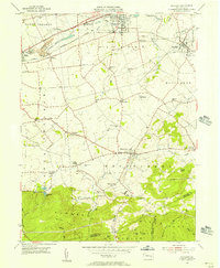
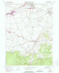
1955 Map of Richland
USGS Topo · Published 1956About this map
The Union Canal (Abnd) and the Reading Line define the northern corridor of this landscape, tracing the evolution of Pennsylvania transport from the era of towpaths to heavy rail. While Myerstown and Richland anchor the northern boundary, the map reveals a dense network of mid-century agricultural hamlets and rural institutions, including the School of Theology and several one-room schoolhouses like Cherry Lane Sch. The terrain shifts dramatically in the south as the open farmland of the Lebanon Valley gives way to the wooded Furnace Hills, where the Horseshoe Trail and Black Oak Trail wind through high ridges. A notable local landmark, the Buffalo Springs Airfield, sits central to the quadrangle, serving as a reminder of the era's small-scale civil aviation before the modern expansion of regional airports.
Find a feature on this map
60 named features on this map. Tap any name to fly to it.
Don’t see what you’re looking for? This feature index may not catch every label — zoom into the map to look around manually.
Map Details
Editions of this 1955 Richland Map
6 editions found
Other maps of this area

1891 · Lebanon
USGS Topo · 1:62,500

1893 · Lebanon
USGS Topo · 1:62,500

1899 · Lebanon
USGS Topo · 1:62,500

1902 · Wernersville
USGS Topo · 1:62,500

1902 · Lancaster
USGS Topo · 1:62,500

1904 · Lancaster
USGS Topo · 1:62,500

1906 · New Holland
USGS Topo · 1:62,500

1908 · New Holland
USGS Topo · 1:62,500

1941 · New Holland
USGS Topo · 1:62,500

1943 · Lancaster
USGS Topo · 1:62,500
Featured Places
- Clay Township, PA
- Richland, PA
- Millcreek Township, PA
- Prescott, South Lebanon Township
- Jackson Township, PA