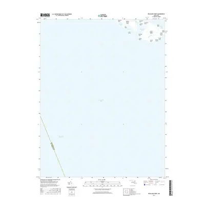
2017 Map of Richland Point
USGS Topo · Published 2017About this map
Middle Hooper Island and Lower Hooper Island form the northern edge of this coastal survey, where the terrestrial landscape yields almost entirely to the Chesapeake Bay. These narrow strips of land are characterized by numerous named points and coves, illustrating a complex shoreline vulnerable to the tides and elements. Notable landmarks for local historians include the curiously named Mens Burial Point and Barbeque Point, alongside family-named features like Billys Point and Nancys Point.
Find a feature on this map
25 named features on this map. Tap any name to fly to it.
Don’t see what you’re looking for? This feature index may not catch every label — zoom into the map to look around manually.
Map Details
Editions of this 2017 Richland Point Map
This is the sole edition of this map. No revisions or reprints were ever made.
Other maps of this area

1892 · Drum Point
USGS Topo · 1:62,500

1894 · Point Lookout
USGS Topo · 1:62,500

1898 · St. Marys
USGS Topo · 1:125,000

1901 · Drum Point
USGS Topo · 1:62,500

1903 · Bloodsworth Island
USGS Topo · 1:62,500

1905 · Crapo
USGS Topo · 1:62,500

1905 · Drum Point
USGS Topo · 1:62,500

1906 · St. Marys
USGS Topo · 1:125,000

1912 · Point Lookout
USGS Topo · 1:62,500

1937 · Point Lookout
USGS Topo · 1:62,500