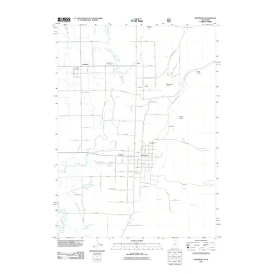
2011 Map of Richmond
USGS Topo · Published 2011About this map
Richmond and Lewiston serve as the primary hubs of this northern Utah landscape, where the agricultural grid meets the winding courses of the Cub River and Bear River. The map details the transition from the settled valley floor to the rising eastern elevations marked by Richmond Knoll and Prater Hollow. Genealogists will find the Richmond City Cemetery and Lewiston City Cemetery clearly marked, alongside essential civic landmarks like the Richmond Post Office and Lewiston Post Office. The area's water management is evident through the East Canal and Morrison Dam, supporting the surrounding small communities of Webster and Cove. Numerous natural springs, including Robinson Spring and Ballantine Spring, dot the terrain near City Creek, illustrating the vital water sources that have sustained this region's local ranching and farming for generations.
Find a feature on this map
108 named features on this map. Tap any name to fly to it.
Don’t see what you’re looking for? This feature index may not catch every label — zoom into the map to look around manually.
Map Details
Editions of this 2011 Richmond Map
This is the sole edition of this map. No revisions or reprints were ever made.
Other maps of this area

1914 · Logan
USGS Topo · 1:125,000

1915 · Preston
USGS Topo · 1:96,000

1916 · Logan
USGS Topo · 1:125,000

1918 · Preston
USGS Topo · 1:125,000

1954 · Ogden
USGS Topo · 1:250,000

1955 · Preston
USGS Topo · 1:250,000

1958 · Ogden
USGS Topo · 1:250,000

1958 · Preston
USGS Topo · 1:250,000

1960 · Ogden
USGS Topo · 1:250,000

1962 · Preston
USGS Topo · 1:250,000