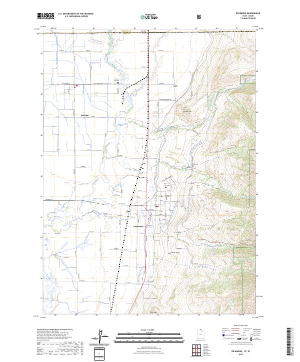
2023 Map of Richmond
USGS Topo · Published 2023About this map
The Bear River and Cub River valley floor transitions into the rising elevations of the Bear River Range on this contemporary survey of the Utah-Idaho border. The agricultural landscape is defined by a complex irrigation network, including the Lower High Creek Canal, Upper High Creek Canal, and the East Pump Canal, which support the farmsteads surrounding Richmond and Lewiston. This water management system underscores the valley's long-standing reliance on mountain runoff for crop production. To the east, the terrain climbs sharply into the Cache National Forest and the protected Mount Naomi Wilderness, where the landscape is carved by drainage features like Prater Hollow and Oxkiller Hollow. Genealogists will find the Richmond City Cem and Lewiston City Cem clearly marked near their respective townsites, while local historians can trace the precise path of the state boundary where Franklin and Cache counties meet.
Find a feature on this map
82 named features on this map. Tap any name to fly to it.
Don’t see what you’re looking for? This feature index may not catch every label — zoom into the map to look around manually.
Map Details
Editions of this 2023 Richmond Map
This is the sole edition of this map. No revisions or reprints were ever made.