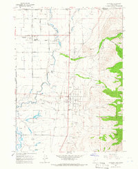
1964 Map of Richmond
USGS Topo · Published 1966About this map
The agricultural and industrial character of the northern Cache Valley is clearly visible in this mid-1960s study, where the Union Pacific railroad and a prominent Sugar Refinery north of Richmond highlight the local sugar beet economy. The landscape is defined by its water management, featuring a network of irrigation ditches like the High Creek Ditch and an Aqueduct that serve the fertile lands between the Bear River and the steep slopes of the Cache National Forest.
Find a feature on this map
51 named features on this map. Tap any name to fly to it.
Don’t see what you’re looking for? This feature index may not catch every label — zoom into the map to look around manually.
Map Details
Editions of this 1964 Richmond Map
This is the sole edition of this map. No revisions or reprints were ever made.
Other maps of this area

1914 · Logan
USGS Topo · 1:125,000

1915 · Preston
USGS Topo · 1:96,000

1916 · Logan
USGS Topo · 1:125,000

1918 · Preston
USGS Topo · 1:125,000

1954 · Ogden
USGS Topo · 1:250,000

1955 · Preston
USGS Topo · 1:250,000

1958 · Ogden
USGS Topo · 1:250,000

1958 · Preston
USGS Topo · 1:250,000

1960 · Ogden
USGS Topo · 1:250,000

1962 · Preston
USGS Topo · 1:250,000