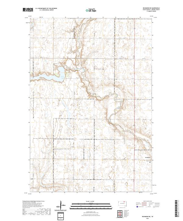
2021 Map of Richmond NE
USGS Topo · Published 2021About this map
Westport occupies the southeastern corner of this Brown County landscape, where the local road network of 120th St and 386th Ave intersects the winding path of the Elm River. The geography is defined by a complex hydraulic system of prairie drainages and wetlands, notably including Willow Creek Lake and the feeder stream Willow Cr to the west. In the northwest, the seasonal course of Dry Run cuts through the high plains, illustrating the subtle elevation changes characteristic of the James River Valley region. These features reflect a legacy of agricultural settlement, where rural life centered on small hubs like Westport and its associated Westport Cem. The grid-like survey lines of t126n r64w and surrounding townships overlay a terrain where water management and land use have long been dictated by the seasonal flow of the river and its tributaries.
Find a feature on this map
26 named features on this map. Tap any name to fly to it.
Don’t see what you’re looking for? This feature index may not catch every label — zoom into the map to look around manually.
Map Details
Editions of this 2021 Richmond NE Map
This is the sole edition of this map. No revisions or reprints were ever made.
Other maps of this area

1894 · Ellendale
USGS Topo · 1:62,500

1894 · Columbia
USGS Topo · 1:62,500

1894 · Savo
USGS Topo · 1:62,500

1896 · Columbia
USGS Topo · 1:125,000

1899 · Ellendale
USGS Topo · 1:125,000

1952 · Ordway
USGS Topo · 1:24,000

1952 · Westport
USGS Topo · 1:24,000

1952 · Richmond NE
USGS Topo · 1:24,000

1953 · Savo SW
USGS Topo · 1:24,000

1953 · Frederick
USGS Topo · 1:24,000