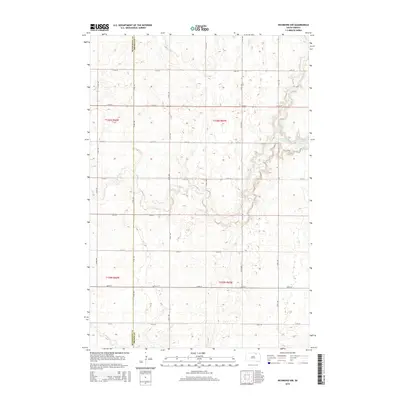
2015 Map of Richmond NW
USGS Topo · Published 2015About this map
The Mcpherson Co Brown Co boundary defines the western edge of this prairie landscape, where the Missouri Plateau transitions into the James River Valley. This 2015 survey reveals a terrain dominated by glacial depressions and seasonal watercourses, most notably the winding path of Willow Creek and its tributary, Willow Cr. In the northeastern portion of the sheet, the waters of Willow Creek Lake form a significant landmark against the strictly gridded section lines. The rural infrastructure is characterized by a precise network of east-west roads, including 114th St and 120th St, which facilitate agricultural movement across the plains. Other hydrological features like Dry Run illustrate the natural drainage patterns that have historically dictated land use and settlement in this portion of the Dakotas.
Find a feature on this map
17 named features on this map. Tap any name to fly to it.
Don’t see what you’re looking for? This feature index may not catch every label — zoom into the map to look around manually.
Map Details
Editions of this 2015 Richmond NW Map
This is the sole edition of this map. No revisions or reprints were ever made.
Other maps of this area

1894 · Ellendale
USGS Topo · 1:62,500

1899 · Ellendale
USGS Topo · 1:125,000

1952 · Richmond NE
USGS Topo · 1:24,000

1953 · Frederick
USGS Topo · 1:24,000

1954 · Aberdeen
USGS Topo · 1:250,000

1956 · Aberdeen
USGS Topo · 1:250,000

1968 · Forbes SE
USGS Topo · 1:24,000
1968 · Frederick SW
USGS Topo · 1:24,000
1970 · Richmond
USGS Topo · 1:24,000

1970 · Wetonka South
USGS Topo · 1:24,000