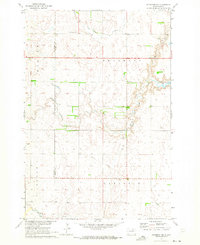
1970 Map of Richmond NW
USGS Topo · Published 1973About this map
United Church of the Brethren Cem sits along the northern edge of this Dakota prairie landscape, marking a quiet center for local genealogy in a region defined by township sections and seasonal watercourses. Surveyed in 1970, the map illustrates the rural transition between Franklin, Lincoln, and Carlisle townships. The drainage patterns of Willow Creek and Dry Run carve subtle relief into the terrain, eventually feeding into Willow Creek Lake in the east. An interesting relic of former transportation is the Old Railroad Grade cutting diagonally through the southern sections, hinting at the shifting logistics of the northern plains. This survey provides a precise record of the land before modern agricultural consolidation, documenting specific Gravel Pits, a local Townhall, and the intricate network of field lines that structured mid-century farm life in the McPherson and Brown County borderlands.
Find a feature on this map
15 named features on this map. Tap any name to fly to it.
Don’t see what you’re looking for? This feature index may not catch every label — zoom into the map to look around manually.
Map Details
Editions of this 1970 Richmond NW Map
This is the sole edition of this map. No revisions or reprints were ever made.
Other maps of this area

1894 · Ellendale
USGS Topo · 1:62,500

1899 · Ellendale
USGS Topo · 1:125,000

1952 · Richmond NE
USGS Topo · 1:24,000

1953 · Frederick
USGS Topo · 1:24,000

1954 · Aberdeen
USGS Topo · 1:250,000

1956 · Aberdeen
USGS Topo · 1:250,000

1968 · Forbes SE
USGS Topo · 1:24,000
1968 · Frederick SW
USGS Topo · 1:24,000
1970 · Richmond
USGS Topo · 1:24,000

1970 · Wetonka South
USGS Topo · 1:24,000