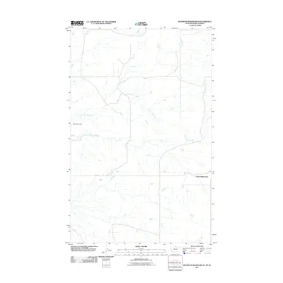
2011 Map of Richmond Reservoir NE
USGS Topo · Published 2011About this map
Cherry Ridge Ranch serves as a lone outpost of settlement in this expansive landscape of Blaine County, Montana, at the turn of the 21st century. The terrain is defined by the winding course of the East Fork Battle Creek, which carves through the northern and central sections of the sheet. Transportation is limited to a sparse network of local routes, most notably Sage Rd, which cuts across the southern portion of the map. This remote area, characterized by geological features like Bennett Coulee, reflects the enduring ranching character of the Montana-Saskatchewan borderlands, where human presence is measured by isolated homesteads and the management of natural watercourses.
Find a feature on this map
4 named features on this map. Tap any name to fly to it.
Don’t see what you’re looking for? This feature index may not catch every label — zoom into the map to look around manually.
Map Details
Editions of this 2011 Richmond Reservoir NE Map
This is the sole edition of this map. No revisions or reprints were ever made.
Other maps of this area

1912 · Zurich
USGS Topo · 1:125,000

1913 · Cherry Ridge
USGS Topo · 1:125,000

1953 · Havre
USGS Topo · 1:250,000

1957 · Havre
USGS Topo · 1:250,000

1958 · Havre
USGS Topo · 1:250,000

1984 · Richmond Reservoir
USGS Topo · 1:24,000
1984 · Richmond Reservoir SW
USGS Topo · 1:24,000
1984 · Silver Bow Lake
USGS Topo · 1:24,000

1984 · Havre
USGS Topo · 1:100,000
1984 · Irvins Coulee
USGS Topo · 1:24,000