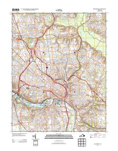
2013 Map of Richmond
USGS Topo · Published 2013About this map
The James River serves as the central anchor for this detailed 2013 survey of the Virginia capital, illustrating the dense urban corridor connecting historic neighborhoods like Manchester and Rocketts Landing. The map highlights the city's complex infrastructure, featuring several prominent crossings including the Manchester Bridge, Mayos Bridge, and the Martin Luther King Junior Memorial Bridge. From the industrial zones near the Richmond Waterworks to the recreational and cultural spaces at the Lewis Ginter Botanical Gardens and The Diamond, the sheet documents a landscape of varied use. Large-scale regional attractions such as the Richmond International Raceway and Virginia State Fairgrounds occupy the northern reaches, while islands like Belle Isle and Mayos Island remain focal points within the river's path. Residential developments such as Ginter Park, Westover Hills, and Montrose Heights reflect the city's outward growth into Henrico County.
Find a feature on this map
68 named features on this map. Tap any name to fly to it.
Don’t see what you’re looking for? This feature index may not catch every label — zoom into the map to look around manually.
Map Details
Editions of this 2013 Richmond Map
This is the sole edition of this map. No revisions or reprints were ever made.
Other maps of this area

1890 · Goochland
USGS Topo · 1:125,000

1892 · Goochland
USGS Topo · 1:125,000

1894 · Bermuda Hundred
USGS Topo · 1:62,500

1894 · Richmond
USGS Topo · 1:62,500

1895 · Richmond
USGS Topo · 1:62,500

1897 · Amelia
USGS Topo · 1:125,000

1934 · Seven Pines
USGS Topo · 1:24,000

1934 · Richmond
USGS Topo · 1:24,000

1936 · Richmond West
USGS Topo · 1:24,000

1936 · Glen Allen
USGS Topo · 1:24,000