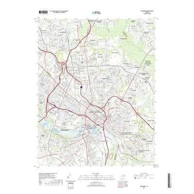
2019 Map of Richmond
USGS Topo · Published 2019About this map
The James River defines the southern heart of this urban landscape, where the historical topography of the Virginia capital is marked by a concentration of cemeteries and national memorial sites. From the sprawling Hollywood Cem overlooking the river to the Richmond National Cemetery in the east, the map documents the city's complex memorial geography. Important cultural landmarks such as the Maggie L Walker National Historic Site and the historic Saint Johns Cem in Church Hill anchor the residential grid.
Find a feature on this map
117 named features on this map. Tap any name to fly to it.
Don’t see what you’re looking for? This feature index may not catch every label — zoom into the map to look around manually.
Map Details
Editions of this 2019 Richmond Map
This is the sole edition of this map. No revisions or reprints were ever made.
Other maps of this area

1890 · Goochland
USGS Topo · 1:125,000

1892 · Goochland
USGS Topo · 1:125,000

1894 · Bermuda Hundred
USGS Topo · 1:62,500

1894 · Richmond
USGS Topo · 1:62,500

1895 · Richmond
USGS Topo · 1:62,500

1897 · Amelia
USGS Topo · 1:125,000

1934 · Seven Pines
USGS Topo · 1:24,000

1934 · Richmond
USGS Topo · 1:24,000

1936 · Richmond West
USGS Topo · 1:24,000

1936 · Glen Allen
USGS Topo · 1:24,000