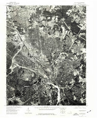
1974 Map of Richmond
USGS Topo · Published 1977About this map
Richmond is captured in high detail at a moment of significant mid-1970s urban evolution in this orthophotograph. Unlike traditional topographic maps, this aerial imagery reveals the actual density of the city center, the complex sprawl of the suburban fringe, and the heavy industrial presence along the James River. The high-contrast photography emphasizes the massive scale of the highway interchanges and the tight grid of the older neighborhoods surrounding the downtown core. It offers a clear view of the state capital's infrastructure, showing the relationship between historic residential districts and the modern transportation corridors that defined the city's growth in this era.
Find a feature on this map
1 named feature on this map. Tap any name to fly to it.
Don’t see what you’re looking for? This feature index may not catch every label — zoom into the map to look around manually.
Map Details
Editions of this 1974 Richmond Map
This is the sole edition of this map. No revisions or reprints were ever made.
Other maps of this area

1890 · Goochland
USGS Topo · 1:125,000

1892 · Goochland
USGS Topo · 1:125,000

1894 · Bermuda Hundred
USGS Topo · 1:62,500

1894 · Richmond
USGS Topo · 1:62,500

1895 · Richmond
USGS Topo · 1:62,500

1897 · Amelia
USGS Topo · 1:125,000

1934 · Seven Pines
USGS Topo · 1:24,000

1934 · Richmond
USGS Topo · 1:24,000

1936 · Richmond West
USGS Topo · 1:24,000

1936 · Glen Allen
USGS Topo · 1:24,000