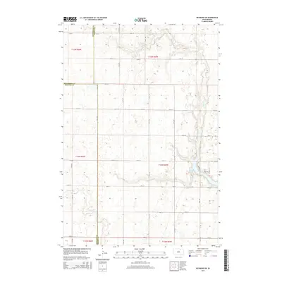
2015 Map of Richmond SW
USGS Topo · Published 2015About this map
Foot Creek winds across a landscape where three counties converge, serving as a primary drainage for this agricultural region of South Dakota. This 2015 U.S. Geological Survey data reflects the rural continuity of the plains, where the grid of the Public Land Survey System strictly dictates the placement of roads and property boundaries. The point where McPherson Co, Brown Co, and Edmunds Co meet is a significant landmark for local history, illustrating how political boundaries were overlaid on the natural drainage of the Foot Cr watershed. The map records the persistence of the section-line road network, a foundational element of the state's rural infrastructure that has remained largely unchanged for over a century.
Find a feature on this map
11 named features on this map. Tap any name to fly to it.
Don’t see what you’re looking for? This feature index may not catch every label — zoom into the map to look around manually.
Map Details
Editions of this 2015 Richmond SW Map
This is the sole edition of this map. No revisions or reprints were ever made.
Other maps of this area

1899 · Ellendale
USGS Topo · 1:125,000

1899 · Northville
USGS Topo · 1:125,000

1952 · Richmond NE
USGS Topo · 1:24,000

1954 · Aberdeen
USGS Topo · 1:250,000

1956 · Aberdeen
USGS Topo · 1:250,000

1960 · Aberdeen West
USGS Topo · 1:24,000

1970 · Lake Parmley
USGS Topo · 1:24,000
1970 · Richmond
USGS Topo · 1:24,000

1970 · Wetonka South
USGS Topo · 1:24,000
1970 · Richmond SW
USGS Topo · 1:24,000