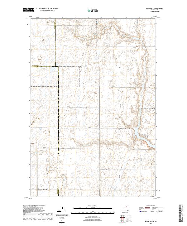
2021 Map of Richmond SW
USGS Topo · Published 2021About this map
The rolling plains of north-central South Dakota are defined by the convergence of three counties: McPherson, Edmunds, and Brown. This prairie landscape is primarily a drainage basin for two major waterways, Foot Creek in the northeast and Snake Creek in the southwest. A rigid grid of section-line roads, such as 375th Ave and 122nd St, provides structure to the open agricultural terrain. In the eastern portion of the map, the road network becomes more complex near Richmond Ln and Richmond Dr, suggesting proximity to a developed recreation area or residential expansion. The presence of numerous small wetlands and depression features across the townships illustrates the glacial history of the region, where water naturally collects in the subtle dips of the high plains.
Find a feature on this map
31 named features on this map. Tap any name to fly to it.
Don’t see what you’re looking for? This feature index may not catch every label — zoom into the map to look around manually.
Map Details
Editions of this 2021 Richmond SW Map
This is the sole edition of this map. No revisions or reprints were ever made.
Other maps of this area

1899 · Ellendale
USGS Topo · 1:125,000

1899 · Northville
USGS Topo · 1:125,000

1952 · Richmond NE
USGS Topo · 1:24,000

1954 · Aberdeen
USGS Topo · 1:250,000

1956 · Aberdeen
USGS Topo · 1:250,000

1960 · Aberdeen West
USGS Topo · 1:24,000

1970 · Lake Parmley
USGS Topo · 1:24,000
1970 · Richmond
USGS Topo · 1:24,000

1970 · Wetonka South
USGS Topo · 1:24,000
1970 · Richmond SW
USGS Topo · 1:24,000