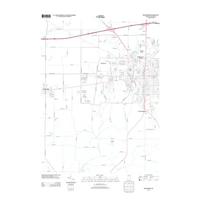
2013 Map of Richmond
USGS Topo · Published 2013About this map
West Fork Whitewater River and its various tributaries converge in this 2013 study of the eastern Indiana landscape. The area is defined by the convergence of several waterways, including Lick Creek, Clear Creek, and the Middle Fork East Fork Whitewater River, which feeds into the Middle Fork Reservoir. This hydrographic network historically shaped the growth of local settlements like Centerville, Spring Grove, and East Haven, which are shown here alongside modern developments.
Find a feature on this map
269 named features on this map. Tap any name to fly to it.
Don’t see what you’re looking for? This feature index may not catch every label — zoom into the map to look around manually.
Map Details
Editions of this 2013 Richmond Map
This is the sole edition of this map. No revisions or reprints were ever made.
Other maps of this area

1915 · New Paris
USGS Topo · 1:48,000

1915 · College Corner
USGS Topo · 1:48,000

1918 · College Corner
USGS Topo · 1:62,500

1918 · New Paris
USGS Topo · 1:62,500

1953 · Cincinnati
USGS Topo · 1:250,000

1956 · Brownsville
USGS Topo · 1:24,000

1957 · Cincinnati
USGS Topo · 1:250,000

1960 · Liberty
USGS Topo · 1:24,000

1960 · Fairhaven
USGS Topo · 1:24,000
1960 · Fountain City
USGS Topo · 1:24,000
Featured Places
- Richmond, IN
- Centerville, IN
- Spring Grove, IN
- South Richmond, Richmond
- Spring Grove Heights, Spring Grove