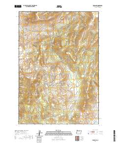
2020 Map of Richmond
USGS Topo · Published 2020About this map
Richmond stands as the primary settlement in this high-desert terrain of Wheeler County, situated where the Richmond Rd winds through a landscape of dramatic elevation changes. The area is defined by massive landforms like Butler Mtn to the north and Iron Mtn to the east, while the central portion is dominated by the broad Mahogany Ridge and the open expanse of Floating Prairie.
Find a feature on this map
33 named features on this map. Tap any name to fly to it.
Don’t see what you’re looking for? This feature index may not catch every label — zoom into the map to look around manually.
Map Details
Editions of this 2020 Richmond Map
This is the sole edition of this map. No revisions or reprints were ever made.
Other maps of this area

1926 · Mitchell
USGS Topo · 1:125,000

1953 · Richmond
USGS Topo · 1:62,500

1953 · Spray
USGS Topo · 1:62,500

1955 · Bend
USGS Topo · 1:250,000

1955 · Canyon City
USGS Topo · 1:250,000

1957 · Bend
USGS Topo · 1:250,000

1958 · Bend
USGS Topo · 1:250,000

1959 · Canyon City
USGS Topo · 1:250,000

1966 · Mitchell
USGS Topo · 1:62,500

1966 · Kinzua
USGS Topo · 1:62,500