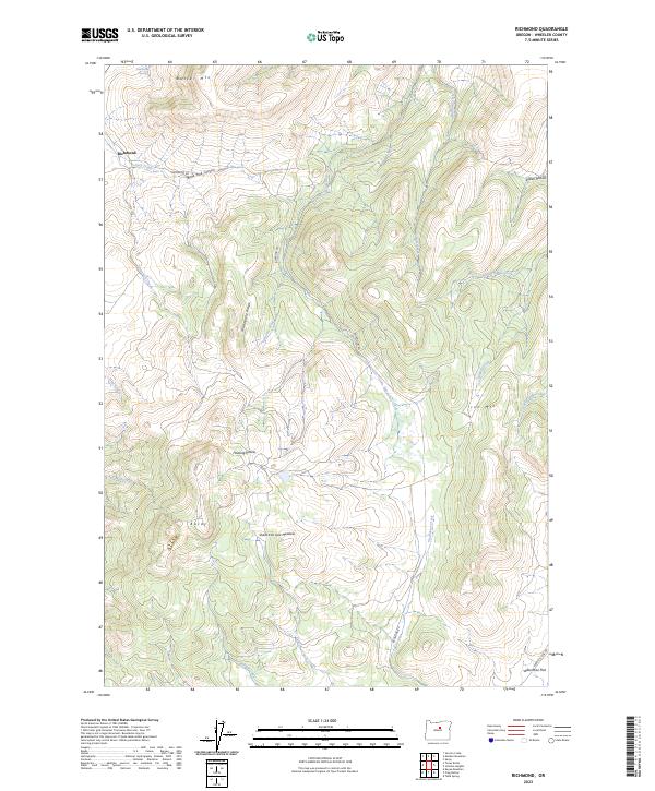
2023 Map of Richmond
USGS Topo · Published 2023About this map
Richmond serves as the primary focal point in this portion of Wheeler County, situated at the junction of Richmond Rd and several seasonal drainage systems. The landscape is defined by a series of prominent high points and ridges, including Butler Mtn, Mahogany Ridge, and Iron Mtn. The topography suggests a history of high-country ranching and grazing, indicated by named open spaces like Floating Prairie, Sheet Iron Jack Meadow, and the expansive Waterman Flat in the southeast.
Find a feature on this map
32 named features on this map. Tap any name to fly to it.
Don’t see what you’re looking for? This feature index may not catch every label — zoom into the map to look around manually.
Map Details
Editions of this 2023 Richmond Map
This is the sole edition of this map. No revisions or reprints were ever made.
Other maps of this area

1926 · Mitchell
USGS Topo · 1:125,000

1953 · Richmond
USGS Topo · 1:62,500

1953 · Spray
USGS Topo · 1:62,500

1955 · Bend
USGS Topo · 1:250,000

1955 · Canyon City
USGS Topo · 1:250,000

1957 · Bend
USGS Topo · 1:250,000

1958 · Bend
USGS Topo · 1:250,000

1959 · Canyon City
USGS Topo · 1:250,000

1966 · Mitchell
USGS Topo · 1:62,500

1966 · Kinzua
USGS Topo · 1:62,500