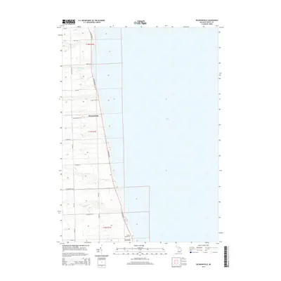
2014 Map of Richmondville
USGS Topo · Published 2014About this map
Lake Huron defines the eastern edge of this coastal survey, where the shoreline of Sanilac County meets the water along a series of bluff-side settlements. The small community of Richmondville sits central to the map, serving as a focal point for the surrounding agricultural landscape. Further south, the settlement of Forester is established near the Forester Township Cem, marking a long-standing local history tied to the lakeshore.
Find a feature on this map
29 named features on this map. Tap any name to fly to it.
Don’t see what you’re looking for? This feature index may not catch every label — zoom into the map to look around manually.
Map Details
Editions of this 2014 Richmondville Map
This is the sole edition of this map. No revisions or reprints were ever made.
Other maps of this area

1954 · Flint
USGS Topo · 1:250,000

1958 · Flint
USGS Topo · 1:250,000

1963 · Forestville
USGS Topo · 1:24,000

1963 · Ruth
USGS Topo · 1:24,000

1963 · Port Sanilac
USGS Topo · 1:24,000

1963 · Deckerville
USGS Topo · 1:24,000

1963 · Richmondville
USGS Topo · 1:24,000
1963 · Carsonville
USGS Topo · 1:24,000

1984 · Harbor Beach
USGS Topo · 1:100,000

1984 · Croswell
USGS Topo · 1:100,000