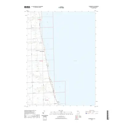
2019 Map of Richmondville
USGS Topo · Published 2019About this map
Lake Huron defines the eastern edge of this Michigan thumb-region landscape, where the coastline is marked by small settlements and numerous creek outlets. The village of Richmondville serves as a central point along the shore, situated where Big Gully Creek and Indian Creek reach the lake. Further south, the settlement of Forester sits near the Forester Township Cemetery, reflecting the long-established community ties in this part of Sanilac County.
Find a feature on this map
28 named features on this map. Tap any name to fly to it.
Don’t see what you’re looking for? This feature index may not catch every label — zoom into the map to look around manually.
Map Details
Editions of this 2019 Richmondville Map
This is the sole edition of this map. No revisions or reprints were ever made.
Other maps of this area

1954 · Flint
USGS Topo · 1:250,000

1958 · Flint
USGS Topo · 1:250,000

1963 · Forestville
USGS Topo · 1:24,000

1963 · Ruth
USGS Topo · 1:24,000

1963 · Port Sanilac
USGS Topo · 1:24,000

1963 · Deckerville
USGS Topo · 1:24,000

1963 · Richmondville
USGS Topo · 1:24,000
1963 · Carsonville
USGS Topo · 1:24,000

1984 · Harbor Beach
USGS Topo · 1:100,000

1984 · Croswell
USGS Topo · 1:100,000