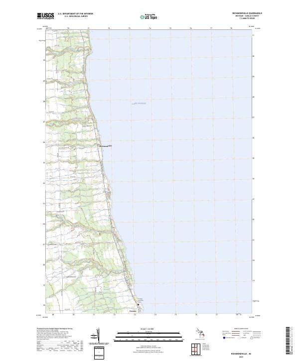
2023 Map of Richmondville
USGS Topo · Published 2023About this map
Lake Huron shoreline vistas define this Sanilac County landscape, where small lakeside settlements sit perched along the coastal bluffs. Richmondville and Forester remain the primary hubs of this rural corridor, linked by the historic path of Lakeshore Rd. The terrain is deeply incised by a series of waterways flowing eastward into the lake, including Elk Creek, Big Gully Creek, and Indian Creek, each carving distinct valleys through the coastal plain.
Find a feature on this map
29 named features on this map. Tap any name to fly to it.
Don’t see what you’re looking for? This feature index may not catch every label — zoom into the map to look around manually.
Map Details
Editions of this 2023 Richmondville Map
This is the sole edition of this map. No revisions or reprints were ever made.
Other maps of this area

1954 · Flint
USGS Topo · 1:250,000

1958 · Flint
USGS Topo · 1:250,000

1963 · Forestville
USGS Topo · 1:24,000

1963 · Ruth
USGS Topo · 1:24,000

1963 · Port Sanilac
USGS Topo · 1:24,000

1963 · Deckerville
USGS Topo · 1:24,000

1963 · Richmondville
USGS Topo · 1:24,000
1963 · Carsonville
USGS Topo · 1:24,000

1984 · Harbor Beach
USGS Topo · 1:100,000

1984 · Croswell
USGS Topo · 1:100,000