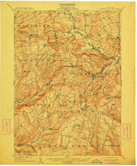
1904 Map of Richmondville
USGS Topo · Published 1911About this map
The Delaware and Hudson RR carves a deep path through the heart of this landscape, following the Schenevus Creek and cutting through the Richmondville hills. This 1904 survey reveals a high density of rural hamlets and corner settlements across the Schoharie and Otsego border, from the established village of Worcester to smaller upland communities like Lutheranville and Eminence. The topography is defined by the steep valleys of the Cobleskill Creek and the Charlotte River, where the rail lines were essential for connecting these remote dairy and hop-farming regions to larger markets.
Find a feature on this map
67 named features on this map. Tap any name to fly to it.
Don’t see what you’re looking for? This feature index may not catch every label — zoom into the map to look around manually.
Map Details
Editions of this 1904 Richmondville Map
5 editions found

Other maps of this area

1896 · Fonda
USGS Topo · 1:62,500

1898 · Fonda
USGS Topo · 1:62,500

1898 · Canajoharie
USGS Topo · 1:62,500

1898 · Schoharie
USGS Topo · 1:62,500

1900 · Canajoharie
USGS Topo · 1:62,500

1900 · Schoharie
USGS Topo · 1:62,500

1901 · Gilboa
USGS Topo · 1:62,500

1902 · Canajoharie
USGS Topo · 1:62,500

1902 · Fonda
USGS Topo · 1:62,500

1903 · Gilboa
USGS Topo · 1:62,500