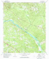
1971 Map of Richtex
USGS Topo · Published 1986About this map
The Broad River serves as the central artery and county line between Fairfield and Richland in this early 1970s landscape. This riverine corridor is defined by numerous islands and shoals, including Haltiwanger Island and Bookman Shoals, where the Southern railroad tracks trace the northern bank through the industrial settlement of Richtex. The presence of several claypits near the rail line suggests a local economy tied to brickmaking or mineral extraction, while the surrounding hills are dotted with rural landmarks that speak to the area's social history.
Find a feature on this map
50 named features on this map. Tap any name to fly to it.
Don’t see what you’re looking for? This feature index may not catch every label — zoom into the map to look around manually.
Map Details
Editions of this 1971 Richtex Map
3 editions found
Other maps of this area

1904 · Columbia
USGS Topo · 1:125,000

1941 · Spartanburg
USGS Topo · 1:250,000

1946 · Irmo
USGS Topo · 1:24,000

1947 · Columbia North
USGS Topo · 1:24,000

1947 · Richtex
USGS Topo · 1:24,000

1948 · Irmo
USGS Topo · 1:24,000

1948 · Columbia North
USGS Topo · 1:24,000

1949 · Richtex
USGS Topo · 1:24,000

1949 · Irmo NE
USGS Topo · 1:24,000

1953 · Spartanburg
USGS Topo · 1:250,000