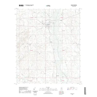
2020 Map of Richton
USGS Topo · Published 2020About this map
Richton stands as the primary hub of this Perry County landscape, where a grid of streets like Mulberry Ave and Front St meets the outlying residential pocket of East Side. The area is defined by the winding course of the Bogue Homo and its various tributaries, including Beaver Dam Cr and White Br. To the south, the settlements of McSwain and Hintonville mark the rural reaches of the county, connected by old thoroughfares such as Old Augusta Rd.
Find a feature on this map
75 named features on this map. Tap any name to fly to it.
Don’t see what you’re looking for? This feature index may not catch every label — zoom into the map to look around manually.
Map Details
Editions of this 2020 Richton Map
This is the sole edition of this map. No revisions or reprints were ever made.
Other maps of this area

1947 · Beaumont
USGS Topo · 1:62,500

1947 · New Augusta
USGS Topo · 1:62,500

1949 · Beaumont
USGS Topo · 1:62,500

1949 · New Augusta
USGS Topo · 1:62,500

1953 · Hattiesburg
USGS Topo · 1:250,000

1958 · Hattiesburg
USGS Topo · 1:250,000

1963 · Brewer
USGS Topo · 1:24,000

1964 · Rhodes
USGS Topo · 1:24,000

1964 · Ovett SE
USGS Topo · 1:24,000

1964 · Ovett
USGS Topo · 1:24,000