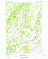
1956 Map of Richville
USGS Topo · Published 1977About this map
The Oswegatchie River meanders through this portion of St. Lawrence County, defining a landscape of agricultural valleys and rocky ridges in the mid-1950s. The village of Richville serves as a local hub, flanked by several rural crossroads including Staplin Corners and Halls Corners. This era reveals a well-established network of community landmarks, from the Billings Sch and Grays Sch to religious centers like North Gouverneur Ch and Welch Ch.
Find a feature on this map
52 named features on this map. Tap any name to fly to it.
Don’t see what you’re looking for? This feature index may not catch every label — zoom into the map to look around manually.
Map Details
Editions of this 1956 Richville Map
3 editions found
Other maps of this area

1904 · Ogdensburg
USGS Topo · 1:62,500

1905 · Ogdensburg
USGS Topo · 1:62,500

1906 · Brier Hill
USGS Topo · 1:62,500

1912 · Hammond
USGS Topo · 1:62,500

1915 · Gouverneur
USGS Topo · 1:62,500

1937 · Gouverneur
USGS Topo · 1:62,500

1943 · Rensselaer Falls
USGS Topo · 1:31,680

1943 · Edwardsville
USGS Topo · 1:31,680
1943 · Heuvelton
USGS Topo · 1:31,680

1944 · Hammond
USGS Topo · 1:62,500