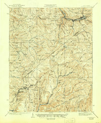
1939 Map of Richwood
USGS Topo · Published 1946About this map
The Cherry River corridor and the surrounding timber and coal lands of Nicholas and Greenbrier counties dominate this 1939 survey. The industrial activity of the era is evident in the rail network of the Chesapeake and Ohio and the numerous company towns and settlements like Richwood, Marfrance, and Quinwood. The landscape is a dense network of ridges and knobs, where local life was anchored by neighborhood institutions such as Hinkle Mountain Church, Namo Chapel, and isolated schools like Bamboo School and Mill Cr School. The map illustrates a period of intense extraction and transport, with Big Clear Mountain and Huggins Ridge overlooking a territory defined by creeks and timber runs. The placement of Linn Low Place and various family-named knobs like Coggins Knob and Pollock Knob offers a detailed view of local topography before more modern industrial shifts.
Find a feature on this map
148 named features on this map. Tap any name to fly to it.
Don’t see what you’re looking for? This feature index may not catch every label — zoom into the map to look around manually.
Map Details
Editions of this 1939 Richwood Map
2 editions found
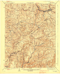
Other maps of this area

1887 · Hinton
USGS Topo · 1:125,000

1887 · Lewisburg
USGS Topo · 1:125,000

1889 · Nicholas
USGS Topo · 1:125,000

1891 · Lewisburg
USGS Topo · 1:125,000

1891 · Nicholas
USGS Topo · 1:125,000

1891 · Huntersville
USGS Topo · 1:125,000

1892 · Hinton
USGS Topo · 1:125,000

1894 · Huntersville
USGS Topo · 1:125,000

1901 · Nicholas
USGS Topo · 1:125,000

1912 · Meadow Creek
USGS Topo · 1:48,000