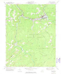
1972 Map of Richwood
USGS Topo · Published 1975About this map
The industrial corridor of the Cherry River defines this portion of Nicholas County, where the B. & O. RR serves a string of mountain communities. Richwood stands as the primary hub, showing a dense concentration of civic infrastructure including an Armory, Milltown Sch, and the Gauley Ranger Station. The map captures the specialized geography of the timber and coal era, as rail lines follow the water through Fenwick and La Frank, while extensive Strip Mine operations and Mine Dump sites appear on the high ridges of Big Mountain and Williamsburg Mountain.
Find a feature on this map
71 named features on this map. Tap any name to fly to it.
Don’t see what you’re looking for? This feature index may not catch every label — zoom into the map to look around manually.
Map Details
Editions of this 1972 Richwood Map
3 editions found
Other maps of this area

1889 · Nicholas
USGS Topo · 1:125,000

1891 · Nicholas
USGS Topo · 1:125,000

1891 · Huntersville
USGS Topo · 1:125,000

1894 · Huntersville
USGS Topo · 1:125,000

1901 · Nicholas
USGS Topo · 1:125,000

1915 · Webster Springs
USGS Topo · 1:48,000

1915 · Cowen
USGS Topo · 1:48,000

1917 · Cowen
USGS Topo · 1:62,500

1918 · Webster Springs
USGS Topo · 1:62,500

1918 · Richwood
USGS Topo · 1:62,500