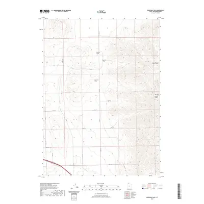
2020 Map of Ridgedale Pass
USGS Topo · Published 2020About this map
Pocatello Valley and Blue Creek Valley meet at the strategic notch of Ridgedale Pass, providing a clear view of the high-desert topography in northern Box Elder County. This 2020 survey details the transition from the broad, lower basin of Blue Cr to the elevated northern valley, bounded to the east by the significant terrain of the West Hills. The map traces a systematic grid of rural access roads, such as 25000 N RD and 21600 N RD, which navigate the wide-open valley floor between dramatic breaks in the landscape like Portage Canyon and the Left Hand Fork Middle Canyon. A notable cultural feature is the Indian Trl skirting the southeastern slopes, suggesting a long-standing movement corridor through this mountain-and-basin province.
Find a feature on this map
15 named features on this map. Tap any name to fly to it.
Don’t see what you’re looking for? This feature index may not catch every label — zoom into the map to look around manually.
Map Details
Editions of this 2020 Ridgedale Pass Map
This is the sole edition of this map. No revisions or reprints were ever made.
Other maps of this area

1954 · Pocatello
USGS Topo · 1:250,000

1954 · Brigham City
USGS Topo · 1:250,000

1958 · Pocatello
USGS Topo · 1:250,000

1958 · Brigham City
USGS Topo · 1:250,000

1962 · Brigham City
USGS Topo · 1:250,000

1968 · Grover Canyon
USGS Topo · 1:24,000

1968 · Samaria
USGS Topo · 1:24,000
1968 · Limekiln Knoll
USGS Topo · 1:24,000

1968 · Howell
USGS Topo · 1:24,000

1968 · Ridgedale Pass
USGS Topo · 1:24,000