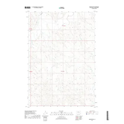
2017 Map of Ridgeview NW
USGS Topo · Published 2017About this map
Moreau River meanders across the northern edge of this Dewey County landscape, defining the local hydrology alongside its significant tributaries. This 2017 survey reveals a terrain shaped by the slow erosion of Cottonwood Cr and Bull Cr, which carve deep drainage patterns through the prairie. The road network is sparse, centered on the transit provided by Bia Rd 2 and the uniquely named On The Tree Rd. While the area lacks large-scale settlements, the map clearly delineates the Public Land Survey System grid, including boundaries for t15n r26e and t14n r26e, which are essential for property researchers and genealogists tracing rural land holdings in the Dakotas.
Find a feature on this map
9 named features on this map. Tap any name to fly to it.
Don’t see what you’re looking for? This feature index may not catch every label — zoom into the map to look around manually.
Map Details
Editions of this 2017 Ridgeview NW Map
This is the sole edition of this map. No revisions or reprints were ever made.
Other maps of this area

1951 · Ridgeview NW
USGS Topo · 1:24,000

1951 · Ridgeview NE
USGS Topo · 1:24,000

1952 · Whitehorse
USGS Topo · 1:24,000

1952 · Parade NE
USGS Topo · 1:24,000

1952 · Glencross SE
USGS Topo · 1:24,000

1953 · McIntosh
USGS Topo · 1:250,000

1958 · McIntosh
USGS Topo · 1:250,000

1978 · Little Moreau Lake
USGS Topo · 1:24,000
1981 · Parade
USGS Topo · 1:24,000
1981 · Ridgeview
USGS Topo · 1:24,000