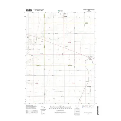
2013 Map of Ridgeville Corners
USGS Topo · Published 2013About this map
Ridgeville Corners serves as the focal point for this rural landscape in Northwest Ohio, situated where the borders of Fulton, Henry, Williams, and Defiance counties converge. The region is defined by its agricultural character and scattered small-scale settlements, including Adams Ridge and Hickory Hills. Education and faith are central to the community's organization, evidenced by the large Northwest State Community Coll campus and a dense concentration of local burial grounds. Many of these, such as Saint Marks Lutheran Cem, Bethlehem Lutheran Cem, and Saint Johns Cem, are closely tied to the area's denominational history. Several family-named agricultural sites like Roselawn Farm and Buehrer Farms are also identified. The drainage pattern is marked by several named watercourses, including Coon Cr, Doty Run, and Garrett Cr, which navigate the flat, surveyed grid of the Public Land Survey System sections.
Find a feature on this map
108 named features on this map. Tap any name to fly to it.
Don’t see what you’re looking for? This feature index may not catch every label — zoom into the map to look around manually.
Map Details
Editions of this 2013 Ridgeville Corners Map
This is the sole edition of this map. No revisions or reprints were ever made.
Other maps of this area

1907 · Defiance
USGS Topo · 1:62,500

1908 · Napoleon
USGS Topo · 1:62,500

1909 · Defiance
USGS Topo · 1:62,500

1911 · Wauseon
USGS Topo · 1:62,500

1913 · Wauseon
USGS Topo · 1:62,500

1913 · Alvordton
USGS Topo · 1:62,500

1943 · Wauseon
USGS Topo · 1:62,500

1944 · Alvordton
USGS Topo · 1:62,500

1953 · Fort Wayne
USGS Topo · 1:250,000

1956 · Fort Wayne
USGS Topo · 1:250,000