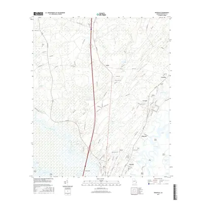
2017 Map of Ridgeville
USGS Topo · Published 2017About this map
The coastal wetlands and river delta of McIntosh County define this part of the Georgia shoreline, where the Altamaha River meets a complex network of marshes and tidal creeks. Smaller settlements like Ridgeville and Ashintilly are situated along the higher ground of the coastal terrace, while the vast reaches of Buffalo Swamp and King Swamp dominate the interior. The landscape is a mix of working timberland and historical cemetery sites, including the Upper Mill Cem and Saint Andrews Cem, reflecting generations of local family residency near Meridian. The presence of Potosi Island and Lewis Island highlights the intricate hydrology of the region, where Cathead Creek and North River carve through the low-lying terrain. This era shows the continued prominence of the river system and local bypasses like Rifle Cut in an area historically shaped by timber and water-based trade.
Find a feature on this map
105 named features on this map. Tap any name to fly to it.
Don’t see what you’re looking for? This feature index may not catch every label — zoom into the map to look around manually.
Map Details
Editions of this 2017 Ridgeville Map
This is the sole edition of this map. No revisions or reprints were ever made.
Other maps of this area

1918 · Everett City
USGS Topo · 1:62,500

1920 · Sapelo River
USGS Topo · 1:62,500

1920 · Everett City
USGS Topo · 1:62,500

1921 · Darien
USGS Topo · 1:62,500

1943 · Ludowici
USGS Topo · 1:62,500

1943 · Sapelo River
USGS Topo · 1:62,500

1944 · Everett City
USGS Topo · 1:62,500

1945 · Sapelo River
USGS Topo · 1:62,500

1946 · Brunswick
USGS Topo · 1:250,000

1948 · Brunswick
USGS Topo · 1:250,000