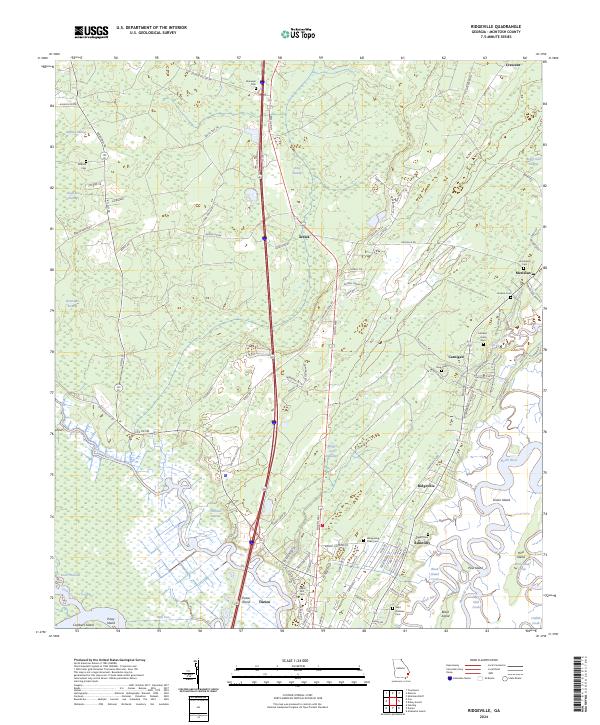
2024 Map of Ridgeville
USGS Topo · Published 2024About this map
Coastal wetlands and intricate tidal networks define this McIntosh County landscape, where the North River and Cathead Creek wind toward the Atlantic. The area is marked by a legacy of plantation-era land divisions and small riverfront settlements like Ashintilly and Ridgeville. The interior is characterized by expansive boggy terrain, including Buffalo Swamp and Chisholm Swamp, which have long influenced the placement of travel routes and homesites. For genealogists, the map is particularly rich in family-named landmarks and burial sites, from the Cuthbert-Grant Cem near Meridian to the Saint Andrews Cem and Upper Mill Cem further south. These sites, along with the remnants of old transport corridors like Plantation Dr and the Rifle Cut, provide a clear picture of how the lowcountry's geography dictated the development of its communities and industries over time.
Find a feature on this map
109 named features on this map. Tap any name to fly to it.
Don’t see what you’re looking for? This feature index may not catch every label — zoom into the map to look around manually.
Map Details
Editions of this 2024 Ridgeville Map
This is the sole edition of this map. No revisions or reprints were ever made.
Other maps of this area

1918 · Everett City
USGS Topo · 1:62,500

1920 · Sapelo River
USGS Topo · 1:62,500

1920 · Everett City
USGS Topo · 1:62,500

1921 · Darien
USGS Topo · 1:62,500

1943 · Ludowici
USGS Topo · 1:62,500

1943 · Sapelo River
USGS Topo · 1:62,500

1944 · Everett City
USGS Topo · 1:62,500

1945 · Sapelo River
USGS Topo · 1:62,500

1946 · Brunswick
USGS Topo · 1:250,000

1948 · Brunswick
USGS Topo · 1:250,000