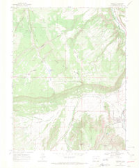
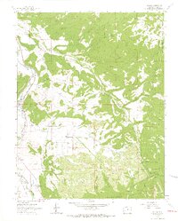
1967 Map of Ridgway
USGS Topo · Published 1971About this map
Ridgway serves as the focal point for this late-1960s survey, situated at the confluence of the Uncompahgre River and Dallas Creek. The landscape is defined by the sharp transition from the irrigated ranch lands of Pleasant Valley to the massive, flat-topped Log Hill Mesa and Burnt Mill Mesa. The transportation infrastructure of the era is clearly marked by the Denver and Rio Grande Western railroad corridor, which follows the river valley northward, while an Old RR Grade hints at the evolving rail network of southwestern Colorado. Water management is a primary feature of the local economy, shown through the intricate paths of the Dallas Ditch, the Elephant Reservoir, and the City Res. Small-scale details for the local historian include the Dallas Park Cem and several high-altitude springs like Montgomery Spring and McKean Spring that supported the area's grazing and mining operations.
Find a feature on this map
34 named features on this map. Tap any name to fly to it.
Don’t see what you’re looking for? This feature index may not catch every label — zoom into the map to look around manually.
Map Details
Editions of this 1967 Ridgway Map
3 editions found
Other maps of this area

1902 · Ouray
USGS Topo · 1:62,500

1904 · Ouray
USGS Topo · 1:62,500

1909 · Montrose
USGS Topo · 1:125,000

1911 · Montrose
USGS Topo · 1:125,000

1955 · Ouray
USGS Topo · 1:24,000

1956 · Montrose
USGS Topo · 1:250,000

1959 · Montrose
USGS Topo · 1:250,000

1960 · Montrose
USGS Topo · 1:250,000
1963 · Buckhorn Lakes
USGS Topo · 1:24,000
1963 · Dallas
USGS Topo · 1:24,000