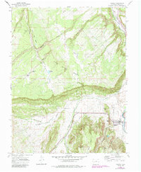
1967 Map of Ridgway
USGS Topo · Published 1984About this map
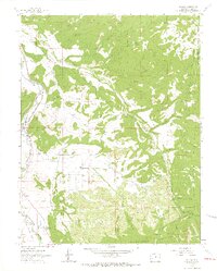
The Uncompahgre River defines the eastern edge of this landscape, where the town of Ridgway sits at the confluence with Dallas Creek. The map documents a transition in transportation and land use, showing the Old Railroad Grade and the Old R. R. Grade tracing the river valley while a network of modern roads and irrigation features like the Dallas Ditch serve the surrounding agricultural flats. Above the town, the terrain rises sharply to Log Hill Mesa and Miller Mesa, separated by deep drainage cuts such as Negro Creek and Fisher Creek. Genealogists and local historians can locate the Dallas Park Cem and several named water sources used by early ranchers, including McKean Spring and Danforth Spring, alongside the high-altitude Fisher Camp and several unnamed mine sites that point to the area's extraction history.
Find a feature on this map
34 named features on this map. Tap any name to fly to it.
Don’t see what you’re looking for? This feature index may not catch every label — zoom into the map to look around manually.
Map Details
Editions of this 1967 Ridgway Map
3 editions found
Other maps of this area

1902 · Ouray
USGS Topo · 1:62,500

1904 · Ouray
USGS Topo · 1:62,500

1909 · Montrose
USGS Topo · 1:125,000

1911 · Montrose
USGS Topo · 1:125,000

1955 · Ouray
USGS Topo · 1:24,000

1956 · Montrose
USGS Topo · 1:250,000

1959 · Montrose
USGS Topo · 1:250,000

1960 · Montrose
USGS Topo · 1:250,000
1963 · Buckhorn Lakes
USGS Topo · 1:24,000
1963 · Dallas
USGS Topo · 1:24,000