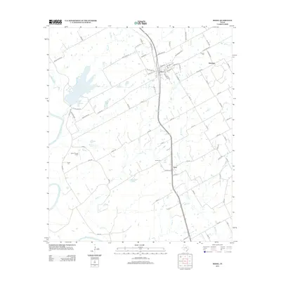
2013 Map of Riesel
USGS Topo · Published 2013About this map
Riesel and the surrounding McLennan County landscape are defined by a network of creeks and small impoundments feeding toward the Brazos River, which clips the southwestern corner of this survey. This agricultural region is punctuated by long-established rural settlements such as Blackland and Perry, connected by a grid of farm-to-market roads and county lanes. The mapping of Lake Cr Lake and smaller bodies like Hesse Lake, Mann Lake, and Able Lake suggests a landscape managed for water resources in the Texas Blackland Prairies. Local heritage is preserved in several small burial grounds, including Friedens Cem near Blackland and Nazare Cem closer to Perry. Transportation and utility corridors are prominent, with the Holict "Private" Airport providing a point of interest for local aviation history among the sprawling tracts of farmland.
Find a feature on this map
83 named features on this map. Tap any name to fly to it.
Don’t see what you’re looking for? This feature index may not catch every label — zoom into the map to look around manually.
Map Details
Editions of this 2013 Riesel Map
This is the sole edition of this map. No revisions or reprints were ever made.
Other maps of this area

1892 · Temple
USGS Topo · 1:125,000

1892 · Waco
USGS Topo · 1:125,000

1920 · Waco
USGS Topo · 1:125,000

1920 · Mart
USGS Topo · 1:62,500

1931 · Elm Mott
USGS Topo · 1:62,500

1954 · Waco
USGS Topo · 1:250,000

1955 · Waco
USGS Topo · 1:250,000

1956 · Mart
USGS Topo · 1:24,000

1957 · Otto
USGS Topo · 1:24,000

1957 · McClanahan
USGS Topo · 1:24,000