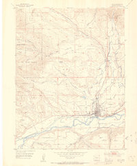
1952 Map of Rifle
USGS Topo · Published 1954About this map
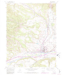
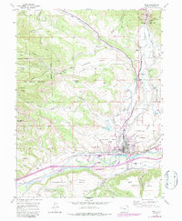
The city of Rifle sits at the heart of this mid-century survey, positioned where Rifle Creek joins the Colorado River. The landscape is defined by its dramatic topography, with high plateaus like Hubbard Mesa, Taughenbaugh Mesa, and Grass Mesa overlooking the river valley. The industrial character of the era is evident through the presence of the Vanadium Mill and the expansive Naval Oil Shale Reserve that occupies the northwestern portion of the map. This reserve, marked by a network of gulches such as Doodlebug Gulch and Yellow Slide Gulch, points to the region's long-standing importance to national energy and mineral interests. Transportation is dominated by the Denver and Rio Grande Western railroad corridor and the winding Government Road, which facilitate movement through this complex terrain of mesas and deep-cut drainages like Government Creek.
Find a feature on this map
40 named features on this map. Tap any name to fly to it.
Don’t see what you’re looking for? This feature index may not catch every label — zoom into the map to look around manually.
Map Details
Editions of this 1952 Rifle Map
7 editions found
Other maps of this area

1906 · Grand Hogback
USGS Topo · 1:125,000

1910 · Grand Hogback
USGS Topo · 1:125,000

1952 · Rio Blanco
USGS Topo · 1:24,000

1952 · Anvil Points
USGS Topo · 1:24,000

1952 · Horse Mountain
USGS Topo · 1:24,000

1952 · Rifle
USGS Topo · 1:24,000

1957 · Leadville
USGS Topo · 1:250,000

1959 · Leadville
USGS Topo · 1:250,000

1960 · Leadville
USGS Topo · 1:250,000

1960 · North Mamm Peak
USGS Topo · 1:24,000