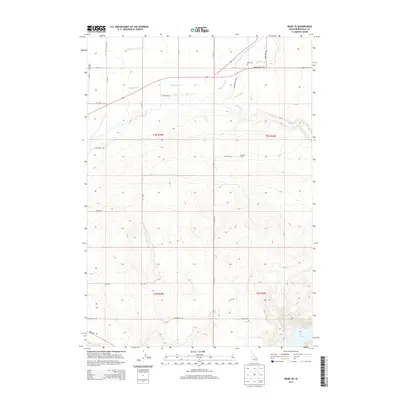
2013 Map of Rigby SE
USGS Topo · Published 2013About this map
The high desert agricultural lands of Bonneville and Jefferson counties are defined by a complex irrigation network, including the Farmers Friend Canal, Anderson Canal, and Eagle Rock Canal. These engineered waterways support the high-altitude farming operations visible at the Milo Dry Farm and throughout the northern half of the map. The terrain transitions from flat, irrigated fields near the Swan Valley Hwy to the steep, dissected ridges of the southeastern corner, where the waters of the Ririe Reservoir are contained. Genealogists and local historians can locate early burial sites at Milo Cem and Ririe Cem, which sit alongside established rural routes like Blacktail Rd and Bone Rd. The landscape demonstrates the long-term reliance on water management to sustain settlement in this part of eastern Idaho.
Find a feature on this map
30 named features on this map. Tap any name to fly to it.
Don’t see what you’re looking for? This feature index may not catch every label — zoom into the map to look around manually.
Map Details
Editions of this 2013 Rigby SE Map
This is the sole edition of this map. No revisions or reprints were ever made.
Other maps of this area

1924 · Hell Creek
USGS Topo · 1:62,500

1924 · Ammon
USGS Topo · 1:62,500

1926 · Hell Creek
USGS Topo · 1:62,500

1948 · Rigby
USGS Topo · 1:24,000

1948 · Ucon
USGS Topo · 1:24,000

1949 · Ucon
USGS Topo · 1:24,000

1949 · Rigby
USGS Topo · 1:24,000

1950 · Ririe
USGS Topo · 1:24,000

1950 · Rigby
USGS Topo · 1:62,500

1950 · Rigby SE
USGS Topo · 1:24,000