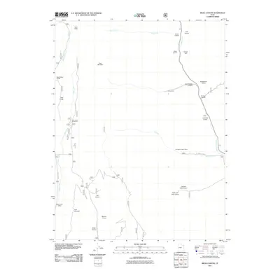
2011 Map of Rilda Canyon
USGS Topo · Published 2011About this map
East Mountain and the high plateaus of the Manti-La Sal National Forest dominate this 2011 survey, where the landscape is defined by deep incisions like Mill Fork Canyon and Crandall Canyon. The map documents the industrial presence of the Wasatch Plateau coal country, marking the Hunington Number 4 Mine and the Coenwal Mine north of the Rilda Canyon area. These operations are situated near the headwaters of Huntington Creek, which flows through the eastern portion of the quadrangle.
Find a feature on this map
31 named features on this map. Tap any name to fly to it.
Don’t see what you’re looking for? This feature index may not catch every label — zoom into the map to look around manually.
Map Details
Editions of this 2011 Rilda Canyon Map
This is the sole edition of this map. No revisions or reprints were ever made.
Other maps of this area

1885 · Manti
USGS Topo · 1:250,000

1895 · Manti
USGS Topo · 1:250,000

1923 · Scofield
USGS Topo · 1:62,500

1923 · Hiawatha
USGS Topo · 1:62,500

1925 · Scofield
USGS Topo · 1:62,500

1925 · Hiawatha
USGS Topo · 1:62,500

1956 · Price
USGS Topo · 1:250,000

1960 · Price
USGS Topo · 1:250,000

1962 · Price
USGS Topo · 1:250,000

1965 · Huntington Reservoir
USGS Topo · 1:24,000