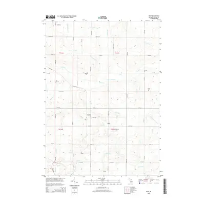
2014 Map of Riley
USGS Topo · Published 2014About this map
Fowler anchors the northwest corner of this agricultural landscape in Clinton County, where a dense network of drainage infrastructure like the Smith and Sutton Drain and Dallas and Bengal Drain supports the fertile terrain. The map captures a transition from the village at Fowler to the small hamlet of Riley, illustrating the traditional Michigan township structure of small rural centers connected by a grid of farm-to-market roads. Several family and community burying grounds are scattered throughout the quadrangle, including the Saint Peters Lutheran Cem and Oak Ridge Cem, which provide significant genealogical touchpoints for local families. The landscape is defined by the headwaters of Stony Creek and the meandering Muskrat Cr, alongside modern developments such as the Forest Hill Airport, showing the evolution of the area's transport and utility over time.
Find a feature on this map
60 named features on this map. Tap any name to fly to it.
Don’t see what you’re looking for? This feature index may not catch every label — zoom into the map to look around manually.
Map Details
Editions of this 2014 Riley Map
This is the sole edition of this map. No revisions or reprints were ever made.
Other maps of this area

1918 · Perrinton
USGS Topo · 1:62,500

1927 · De Witt
USGS Topo · 1:62,500

1943 · Perrinton
USGS Topo · 1:62,500

1945 · Portland
USGS Topo · 1:62,500

1954 · Midland
USGS Topo · 1:250,000

1958 · Midland
USGS Topo · 1:250,000

1958 · Grand Rapids
USGS Topo · 1:250,000

1959 · Midland
USGS Topo · 1:250,000

1961 · Grand Rapids
USGS Topo · 1:250,000

1962 · Grand Rapids
USGS Topo · 1:250,000