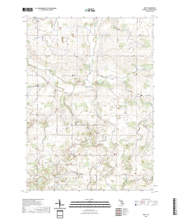
2023 Map of Riley
USGS Topo · Published 2023About this map
Agricultural drainage and family history define this portion of Clinton County, where the landscape is intricately carved by an extensive network of waterways like the Dallas and Bengal Drain, Smith and Sutton Drain, and Nuffer and Sturgis Drain. The settlement of Riley sits centrally, supported by the small Forest Hill Airport nearby. For genealogists and local historians, the area is notable for its numerous burial grounds, including the Saint Peter's Lutheran Cem near Church Rd and the Oak Ridge Cem further north. The map also captures the village of Fowler in the northwest corner, marking a transition between the established grid of country roads and the meandering courses of Stony Creek and Muskrat Creek. Natural features like Mud Lake in the south provide a contrast to the highly engineered drainage systems that have supported this Michigan farming community for generations.
Find a feature on this map
58 named features on this map. Tap any name to fly to it.
Don’t see what you’re looking for? This feature index may not catch every label — zoom into the map to look around manually.
Map Details
Editions of this 2023 Riley Map
This is the sole edition of this map. No revisions or reprints were ever made.
Other maps of this area

1918 · Perrinton
USGS Topo · 1:62,500

1927 · De Witt
USGS Topo · 1:62,500

1943 · Perrinton
USGS Topo · 1:62,500

1945 · Portland
USGS Topo · 1:62,500

1954 · Midland
USGS Topo · 1:250,000

1958 · Midland
USGS Topo · 1:250,000

1958 · Grand Rapids
USGS Topo · 1:250,000

1959 · Midland
USGS Topo · 1:250,000

1961 · Grand Rapids
USGS Topo · 1:250,000

1962 · Grand Rapids
USGS Topo · 1:250,000