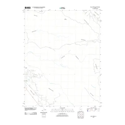
2010 Map of Rill Creek
USGS Topo · Published 2010About this map
Spanish Valley and the surrounding high mesas define this section of southeastern Utah as documented in 2010. The landscape is carved by complex drainages including Negro Bill Canyon, Drinks Canyon, and Jackass Canyon, which cut through the prominent Porcupine Rim. Human infrastructure is concentrated in the southwest corner where residential streets like Juniper Dr and E Bench Rd meet the valley floor near Pack Creek. This map captures a specific moment in time for local landmarks, showing the proximity of the Sunset Cemetery to the Sunbird Airport. Higher elevations are marked by distinctive natural formations such as Coffee Pot Rock and the extensive tablelands of Wilson Mesa and South Mesa. The network of backroads, including Sand Flats Rd, provides clear documentation of the corridor between the canyons and Castle Valley to the northeast.
Find a feature on this map
28 named features on this map. Tap any name to fly to it.
Don’t see what you’re looking for? This feature index may not catch every label — zoom into the map to look around manually.
Map Details
Editions of this 2010 Rill Creek Map
This is the sole edition of this map. No revisions or reprints were ever made.
Other maps of this area

1885 · La Sal
USGS Topo · 1:250,000

1954 · Mt Peale 2 NW
USGS Topo · 1:24,000

1954 · Mt. Waas 3 NE
USGS Topo · 1:24,000

1954 · Mt. Waas 3 SE
USGS Topo · 1:24,000

1954 · Carlisle 1 NE
USGS Topo · 1:24,000

1954 · Mt Peale 2 NE
USGS Topo · 1:24,000

1954 · Mt. Waas 3 NW
USGS Topo · 1:24,000

1954 · Mt. Waas 3 SW
USGS Topo · 1:24,000

1954 · La Sal Junction
USGS Topo · 1:62,500

1954 · Castle Valley
USGS Topo · 1:62,500