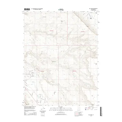
2014 Map of Rill Creek
USGS Topo · Published 2014About this map
Castle Valley and its high desert surroundings are captured in this early 21st-century record of eastern Utah's canyon country. The landscape is defined by massive geological benches and plateaus, most notably Porcupine Rim and Wilson Mesa, which tower over the intricate drainage systems of Rill Cr and N Fork Mill Cr. To the southwest, residential development along the Spanish Valley Dr corridor is visible near Sunset Cem, showing the proximity of modern infrastructure to the base of S Mesa. Local landmarks such as Coffee Pot Rock and the interestingly named Johnsons Up on Top indicate the distinct topographical features used by residents to navigate this complex terrain. The map also traces Us-191 as it skirts the western edge of the mesa lands, providing a clear view of how transportation routes are dictated by the dramatic elevation changes between Jackass Canyon and the valley floor.
Find a feature on this map
53 named features on this map. Tap any name to fly to it.
Don’t see what you’re looking for? This feature index may not catch every label — zoom into the map to look around manually.
Map Details
Editions of this 2014 Rill Creek Map
This is the sole edition of this map. No revisions or reprints were ever made.
Other maps of this area

1885 · La Sal
USGS Topo · 1:250,000

1954 · Mt Peale 2 NW
USGS Topo · 1:24,000

1954 · Mt. Waas 3 NE
USGS Topo · 1:24,000

1954 · Mt. Waas 3 SE
USGS Topo · 1:24,000

1954 · Carlisle 1 NE
USGS Topo · 1:24,000

1954 · Mt Peale 2 NE
USGS Topo · 1:24,000

1954 · Mt. Waas 3 NW
USGS Topo · 1:24,000

1954 · Mt. Waas 3 SW
USGS Topo · 1:24,000

1954 · La Sal Junction
USGS Topo · 1:62,500

1954 · Castle Valley
USGS Topo · 1:62,500