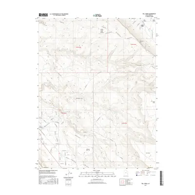
2017 Map of Rill Creek
USGS Topo · Published 2017About this map
Castle Valley and the surrounding high desert mesas are detailed in this 2017 survey of Grand County. The landscape is defined by massive topographical shifts, from the prominent Porcupine Rim and the soaring height of Wilson Mesa to the drainage of Rill Creek. The map documents a mix of residential development and agricultural land use, particularly in the northern reaches where roads like Castle Valley Dr and W Holyoak Ln provide access to property near Placer Cr. To the south, the terrain becomes increasingly complex as it climbs toward the South Mesa and the expansive Johnsons Up On Top. This modern edition provides a clear view of how rural infrastructure navigates the dramatic geology of the Colorado Plateau, including the route through Flat Pass and the layout of the Sunset Memorial Gardens Cem near the Spanish Valley area.
Find a feature on this map
53 named features on this map. Tap any name to fly to it.
Don’t see what you’re looking for? This feature index may not catch every label — zoom into the map to look around manually.
Map Details
Editions of this 2017 Rill Creek Map
This is the sole edition of this map. No revisions or reprints were ever made.
Other maps of this area

1885 · La Sal
USGS Topo · 1:250,000

1954 · Mt Peale 2 NW
USGS Topo · 1:24,000

1954 · Mt. Waas 3 NE
USGS Topo · 1:24,000

1954 · Mt. Waas 3 SE
USGS Topo · 1:24,000

1954 · Carlisle 1 NE
USGS Topo · 1:24,000

1954 · Mt Peale 2 NE
USGS Topo · 1:24,000

1954 · Mt. Waas 3 NW
USGS Topo · 1:24,000

1954 · Mt. Waas 3 SW
USGS Topo · 1:24,000

1954 · La Sal Junction
USGS Topo · 1:62,500

1954 · Castle Valley
USGS Topo · 1:62,500