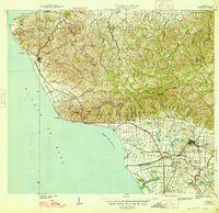
1947 Map of Rincon
USGS Topo · Published 1947About this map
Sugarcane agriculture and rail transport dominate the coastal plains of the Bahía de Añasco in the late 1940s. The American Railroad of Porto Rico tracks follow the shoreline, serving the coastal town of Rincón and the inland municipality of Añasco. This period of industrial agriculture is marked by numerous agricultural colonies, including Colonia Libertad, Colonia Concepción, and Colonia Ursula, clustered around Central Igualdad. These settlements and the Estación Añasco railway stop represent a landscape defined by the sugar economy before later modernization.
Find a feature on this map
115 named features on this map. Tap any name to fly to it.
Don’t see what you’re looking for? This feature index may not catch every label — zoom into the map to look around manually.
Map Details
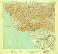
Editions of this 1947 Rincon Map
2 editions found
Other maps of this area

1937 · Aguadilla
USGS Topo · 1:20,000

1937 · Moca
USGS Topo · 1:20,000

1938 · Alto Sano
USGS Topo · 1:20,000

1939 · Mayaguez
USGS Topo · 1:30,000

1941 · Moca
USGS Topo · 1:30,000

1941 · Rincon
USGS Topo · 1:30,000

1941 · Rincon
USGS Topo · 1:30,000

1941 · Rosario
USGS Topo · 1:30,000

1942 · Moca
USGS Topo · 1:30,000

1942 · Central La Plata
USGS Topo · 1:30,000