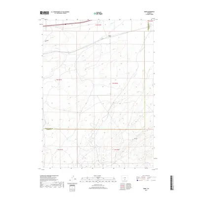
2017 Map of Riner
USGS Topo · Published 2017About this map
Riner serves as the primary focal point of this 2017 high-desert survey, situated along the northern reach of the quadrangle. The landscape is defined by the high-altitude hydrology of the Great Divide Basin, where seasonal drainages like Separation Cr and Fillmore Cr cut through the arid terrain. The map captures the meeting of administrative boundaries, specifically where the line for Sweetwater Co and Carbon Co divides the southern and eastern portions of the sheet. Notable topographical landmarks include the prominence of Cherokee Hill in the northwest and the distinctive Red Rim to the southeast. The area's connectivity is dictated by Riner Rd, which navigates the subtle shifts in elevation across this expanse of public and private land. This map provides a precise look at the modern surveying of the Wyoming interior, documenting the persistent features of this remote basin.
Find a feature on this map
13 named features on this map. Tap any name to fly to it.
Don’t see what you’re looking for? This feature index may not catch every label — zoom into the map to look around manually.
Map Details
Editions of this 2017 Riner Map
This is the sole edition of this map. No revisions or reprints were ever made.
Other maps of this area

1954 · Rawlins
USGS Topo · 1:250,000

1956 · Rawlins Peak
USGS Topo · 1:62,500

1956 · Bridger Pass
USGS Topo · 1:62,500

1958 · Rawlins
USGS Topo · 1:250,000

1962 · Rawlins
USGS Topo · 1:250,000

1966 · Jawbone Ranch
USGS Topo · 1:24,000

1966 · Creston Junction
USGS Topo · 1:24,000

1966 · Seaverson Reservoir
USGS Topo · 1:24,000

1966 · Riner
USGS Topo · 1:24,000

1966 · Fillmore Ranch
USGS Topo · 1:24,000