
1983 Map of Ringgold
USGS Topo · Published 1986About this map
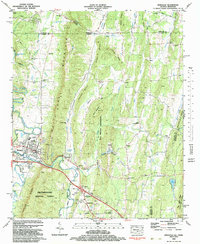
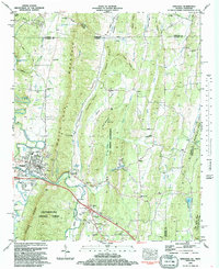
Ringgold serves as the focal point of this Northwest Georgia landscape, situated where the Seaboard railroad and Interstate 75 cross the waters of South Chickamauga Creek. The terrain is defined by the sharp parallel ridges of White Oak Mountain and Taylor Ridge, which channel development into the fertile Cherokee Valley. Small communities such as Shookville and Sugartown are scattered along the valley floors, while historic landmarks like Catoosa Springs and Cherokee Springs highlight the importance of the area's natural hydrology. The eastern portion of the map transition into the Chattahoochee National Forest, and a prominent U.S. Military Reservation occupies the central valley near Salem. Local genealogy is well-supported by numerous rural landmarks, including Salem Cem, Gordy Cem, and churches like Friendship Ch and Ebenezer Ch.
Find a feature on this map
61 named features on this map. Tap any name to fly to it.
Don’t see what you’re looking for? This feature index may not catch every label — zoom into the map to look around manually.
Map Details
Editions of this 1983 Ringgold Map
Other maps of this area

1886 · Dalton
USGS Topo · 1:125,000

1886 · Cleveland
USGS Topo · 1:125,000

1886 · Ringgold
USGS Topo · 1:125,000

1888 · Chattanooga
USGS Topo · 1:125,000

1892 · Ringgold
USGS Topo · 1:125,000

1892 · Cleveland
USGS Topo · 1:125,000

1892 · Dalton
USGS Topo · 1:125,000

1893 · Chattanooga
USGS Topo · 1:125,000

1895 · Cleveland
USGS Topo · 1:125,000

1897 · Dalton
USGS Topo · 1:125,000