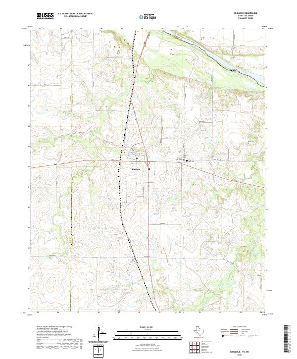
2022 Map of Ringgold
USGS Topo · Published 2022About this map
Ringgold sits at a critical junction in northern Montague County, positioned where major transportation routes converge just south of the Red River border with Oklahoma. The landscape is defined by the winding drainages of Beaver Cr and Belknap Cr, which carve through the terrain as they flow toward the river valley. This survey reveals a deeply rooted community structure, evidenced by the clustered burial grounds of Ringgold Cem - West, Ringgold Cem, and Ringgold Cem - East that serve the settlement.
Find a feature on this map
41 named features on this map. Tap any name to fly to it.
Don’t see what you’re looking for? This feature index may not catch every label — zoom into the map to look around manually.
Map Details
Editions of this 2022 Ringgold Map
This is the sole edition of this map. No revisions or reprints were ever made.
Other maps of this area

1905 · Montague
USGS Topo · 1:125,000

1954 · Sherman
USGS Topo · 1:250,000

1954 · Wichita Falls
USGS Topo · 1:250,000

1956 · Henrietta
USGS Topo · 1:62,500

1958 · Wichita Falls
USGS Topo · 1:250,000

1958 · Sherman
USGS Topo · 1:250,000

1960 · Buzzard Roost Knob
USGS Topo · 1:24,000

1961 · Stoneburg
USGS Topo · 1:24,000
1968 · Bellevue
USGS Topo · 1:24,000
1968 · Terral
USGS Topo · 1:24,000