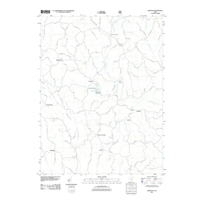
2011 Map of Ringgold
USGS Topo · Published 2011About this map
Ringgold and Rosseau anchor this landscape of the Unglaciated Allegheny Plateau in Morgan County, where the topography is defined by the dendritic drainage of West Branch Wolf Creek and Sharps Fork Federal Creek. This 2011 map reveals a community-focused rural layout where small settlements like Elliott Crossroads and Westland are marked by concentrations of family and church-affiliated burial grounds. Notable sites for local history include the Pisgah Methodist Protestant Cemetery and Antioch Cemetery, which reflect the area's early denominational ties. The land use is characterized by narrow ridge-top roads like Glass Rd NW and Butler Rd that wind between steep-walled valleys. Hydrological features such as the Comstock Pond Dam and the various branches of Wolf Creek show the modern management of water resources within this traditional agricultural and wooded terrain.
Find a feature on this map
107 named features on this map. Tap any name to fly to it.
Don’t see what you’re looking for? This feature index may not catch every label — zoom into the map to look around manually.
Map Details
Editions of this 2011 Ringgold Map
This is the sole edition of this map. No revisions or reprints were ever made.
Other maps of this area

1903 · Athens
USGS Topo · 1:62,500

1904 · Chesterhill
USGS Topo · 1:62,500

1905 · Athens
USGS Topo · 1:62,500

1906 · Chesterhill
USGS Topo · 1:62,500

1910 · Mc Connelsville
USGS Topo · 1:62,500

1911 · New Lexington
USGS Topo · 1:62,500

1947 · Columbus
USGS Topo · 1:250,000

1949 · Clarksburg
USGS Topo · 1:250,000

1956 · Clarksburg
USGS Topo · 1:250,000

1960 · Amesville
USGS Topo · 1:24,000