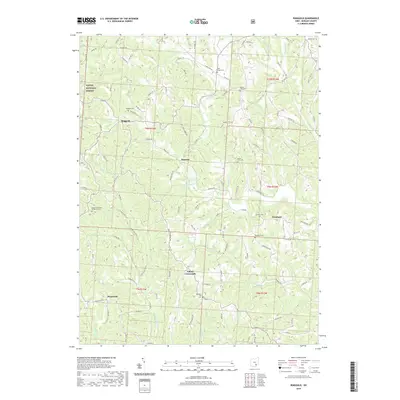
2019 Map of Ringgold
USGS Topo · Published 2019About this map
Ringgold and its surrounding hill country in Morgan County are defined by a network of rural settlements and family cemeteries. This part of the Wayne National Forest is characterized by narrow ridge roads like Rainey Hill Rd and Rosseau Hill Ln that separate the various forks of the Wolf Creek watershed. The map reveals a high concentration of burial grounds associated with small congregations, including the Pisgah Methodist Protestant Cem and Antioch Cem, which speak to the long-standing community hubs in Westland and Mountville. The hydrography of the region is dominated by winding runs such as W Br Wolf Cr and Sharps Fork Federal Cr, alongside smaller features like Comstock Pond. This landscape reflects the enduring rural character of southeastern Ohio, where intersections like Elliott Crossroads remain the primary landmarks for local navigation.
Find a feature on this map
107 named features on this map. Tap any name to fly to it.
Don’t see what you’re looking for? This feature index may not catch every label — zoom into the map to look around manually.
Map Details
Editions of this 2019 Ringgold Map
This is the sole edition of this map. No revisions or reprints were ever made.
Other maps of this area

1903 · Athens
USGS Topo · 1:62,500

1904 · Chesterhill
USGS Topo · 1:62,500

1905 · Athens
USGS Topo · 1:62,500

1906 · Chesterhill
USGS Topo · 1:62,500

1910 · Mc Connelsville
USGS Topo · 1:62,500

1911 · New Lexington
USGS Topo · 1:62,500

1947 · Columbus
USGS Topo · 1:250,000

1949 · Clarksburg
USGS Topo · 1:250,000

1956 · Clarksburg
USGS Topo · 1:250,000

1960 · Amesville
USGS Topo · 1:24,000