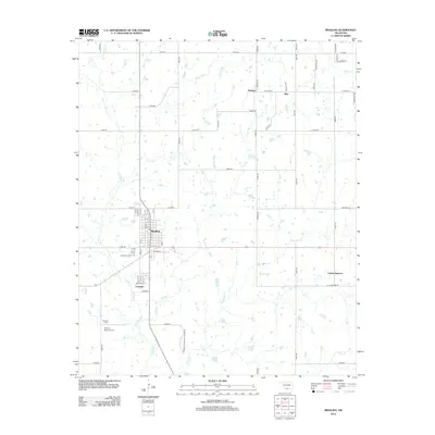
2012 Map of Ringling
USGS Topo · Published 2012About this map
Ringling and the adjacent settlement of Cornish anchor this Southern Oklahoma landscape, where the street grid of Ringling transitions into a countryside defined by intermittent creek beds and rural roads. The area is characterized by a network of drainage ways including Post Oak Cr, Long Br, and N Mud Cr, which carve through the plains. Further north, the settlements of Dundee and Wirt appear along the section lines, connected by W Texas St.
Find a feature on this map
65 named features on this map. Tap any name to fly to it.
Don’t see what you’re looking for? This feature index may not catch every label — zoom into the map to look around manually.
Map Details
Editions of this 2012 Ringling Map
This is the sole edition of this map. No revisions or reprints were ever made.
Other maps of this area

1901 · Addington
USGS Topo · 1:125,000

1901 · Ardmore
USGS Topo · 1:125,000

1918 · Ardmore
USGS Topo · 1:125,000

1957 · Ardmore
USGS Topo · 1:250,000

1963 · Ardmore
USGS Topo · 1:250,000

1969 · Healdton
USGS Topo · 1:24,000
1969 · Healdton SW
USGS Topo · 1:24,000
1969 · Fox
USGS Topo · 1:24,000
1974 · Orr
USGS Topo · 1:24,000

1974 · Ringling NW
USGS Topo · 1:24,000