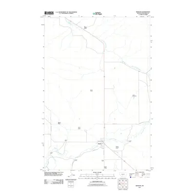
2011 Map of Ringling
USGS Topo · Published 2011About this map
Ringling serves as the central hub of this Meagher County landscape, where the Ringling Post Office and Higgins Brothers Airport anchor a region defined by expansive ranching operations and water rights. The settlement pattern follows the drainage of Sixteenmile Creek and the South Fork Smith River, with numerous family-named landmarks such as the Adkison Ranch, Brewer Ranch, and Quigley Ranch illustrating the enduring agricultural footprint of the area.
Find a feature on this map
24 named features on this map. Tap any name to fly to it.
Don’t see what you’re looking for? This feature index may not catch every label — zoom into the map to look around manually.
Map Details
Editions of this 2011 Ringling Map
This is the sole edition of this map. No revisions or reprints were ever made.
Other maps of this area

1886 · Little Belt Mts.
USGS Topo · 1:250,000

1894 · Little Belt Mts.
USGS Topo · 1:250,000

1897 · Little Belt Mts.
USGS Topo · 1:250,000

1898 · Little Belt Mts.
USGS Topo · 1:250,000

1902 · Little Belt Mts.
USGS Topo · 1:250,000

1948 · White Sulphur Springs
USGS Topo · 1:250,000

1948 · Sixteen
USGS Topo · 1:24,000

1951 · Sixteen NE
USGS Topo · 1:24,000

1951 · Hamen
USGS Topo · 1:24,000
1951 · Wolf Hill
USGS Topo · 1:24,000